
Story
7-Day Outlook: Saturday Brings Wilmington's Best Storm Chance
September 10, 2026
weather, forecast
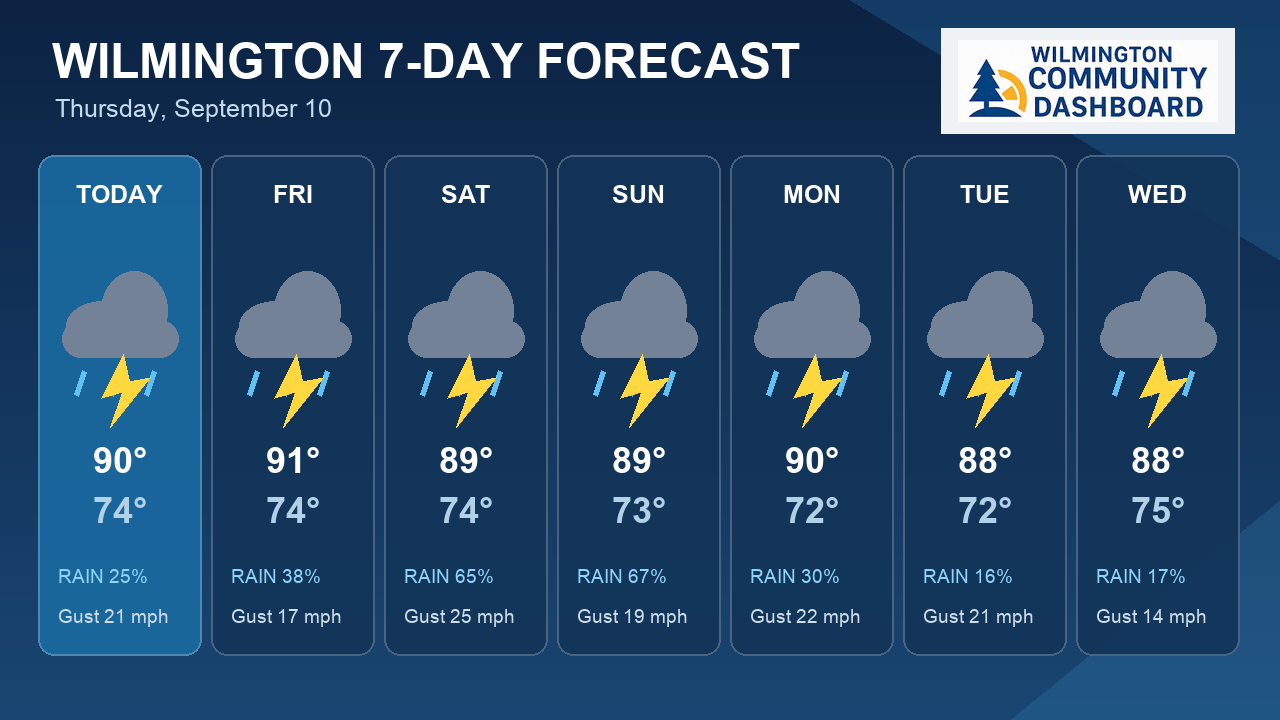
Wilmington, North Carolina — The next seven days bring highs ranging from 88°F to 91°F, lows from 72°F to 75°F, rain chances focused on Saturday and Sunday.
⚠️ Active Weather Alerts
- 🔵 Coastal Flood Advisory: Coastal Flood Advisory issued September 10 at 2:45AM EDT until September 11 at 12:00AM EDT by NWS Wilmington NC
- If travel is required, allow extra time as some roads may be
closed. Do not drive around barricades or through water of
unknown depth. Take the necessary actions to protect flood-prone
property.
What Matters Most This Week
- Warmest day: Friday, with a high near 91°F.
- Coolest morning: Monday, with a low near 72°F.
- Rain chances: NWS indicates the best chances on Saturday and Sunday.
- Storm watch: Thunderstorm chances appear in the forecast on Today, Friday, Saturday, Sunday, Monday, Tuesday and Wednesday.
- Windiest stretch: Saturday, with gusts up to 25 mph.
- Sun safety: UV runs high on Today, Friday, Saturday and Monday and other days.
7-Day Forecast
| Day | Conditions | High / Low | Rain | Peak Gust |
|---|---|---|---|---|
| Today 9/10 | Sunny then Slight Chance Showers And Thunderstorms | 90° / 74° | 25% | 21 mph |
| Friday 9/11 | Mostly Sunny then Chance Showers And Thunderstorms | 91° / 74° | 38% | 17 mph |
| Saturday 9/12 | Slight Chance Showers And Thunderstorms then Showers And Thunderstorms Likely | 89° / 74° | 65% | 25 mph |
| Sunday 9/13 | Chance Showers And Thunderstorms | 89° / 73° | 67% | 19 mph |
| Monday 9/14 | Mostly Sunny then Chance Showers And Thunderstorms | 90° / 72° | 30% | 22 mph |
| Tuesday 9/15 | Sunny then Slight Chance Showers And Thunderstorms | 88° / 72° | 16% | 21 mph |
| Wednesday 9/16 | Slight Chance Showers And Thunderstorms | 88° / 75° | 17% | 14 mph |
Today's Details — Thursday, September 10
- Conditions: Sunny then Slight Chance Showers And Thunderstorms
- High / Low: 90°F / 74°F
- Wind: SSW 10 mph, gusts to 21 mph
- Precipitation: 25% chance (National Weather Service forecast)
- UV Index: 7.1 — Very High — limit outdoor exposure
- Sunrise / Sunset: 05:51 / 18:25
- Daylight: 12.6 hours
What Matters Most Today
- Sun safety: UV index reaches 7.1; sunscreen still matters even with cloud cover.
- Best outdoor window: Morning (lowest average rain risk).
Comfort & Conditions
- Humidity: 72%
- Dew Point: Up to 75°F — muggy conditions
Hour-by-Hour Breakdown
- Morning (6AM–Noon): Clear sky, 78°F, 80% humidity
- Afternoon (Noon–6PM): Clear sky, 88°F, 61% humidity
- Evening (6PM–Midnight): Clear sky, 80°F, 84% humidity
Air Quality & Allergens
- Air Quality Index: 45 (peak 48) — Good
- PM2.5: 11.1 µg/m³
Temperatures, conditions, and precipitation chances use National Weather Service forecast guidance. Open-Meteo supplies supplemental wind, UV, humidity, and air-quality fields; its precipitation totals are not used. For weather alerts, visit your local National Weather Service office.
Share this story